
Spain · Western Mediterranean
Balearic Islands
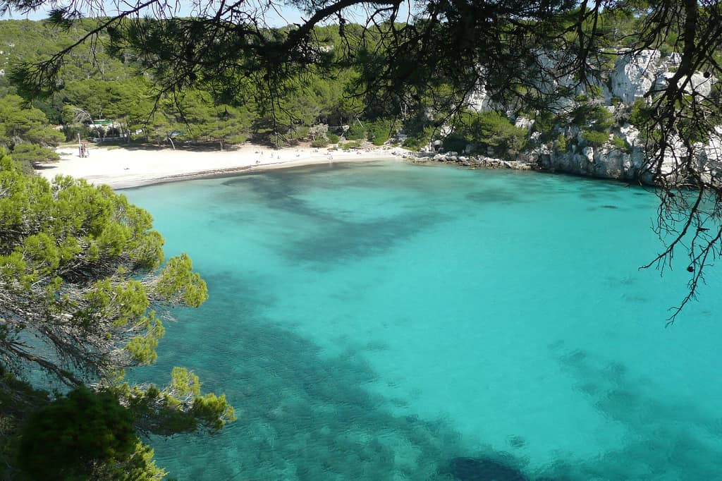
Mallorca, Menorca, Ibiza and Formentera – coves with Caribbean-like waters.
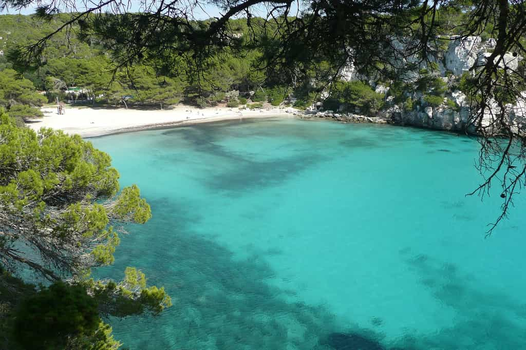
Cala Macarella auf Menorca, Balearen, Spanien · Photo: Paul Stephenson · CC BY 2.0, Wikimedia Commons
The sailing area
Balearic Islands · Spain · Western Mediterranean
The Balearic Islands offer turquoise coves, lively harbours and quick crossings between the islands. Mallorca is the largest charter hub, Menorca its quieter sister with a biosphere reserve, while Ibiza and Formentera beckon with sandy beaches.
Important: Seagrass meadows (Posidonia) are strictly protected in many bays. Anchoring is only permitted on sand, and mooring buoys often need to be booked online during the season.
Nautical chart with anchorages
Nautical chart requires consent
To display the chart, map tiles are loaded from OpenStreetMap and OpenSeaMap. This transmits your IP address to their servers. Privacy policy
Anchorages in Balearic Islands
Bays, harbours and mooring fields in Spain. Coordinates are approximate and not for navigation. Google Maps shows a place search, not a verified anchoring position.
- 1
Cala Macarella (Menorca)
Bay · 39.938° N, 3.939° E
Picture-postcard bay in southern Menorca.
Search in Google Maps - 2
Cala Turqueta (Menorca)
Bay · 39.932° N, 3.914° E
White sand and pine trees; only suitable in northerly winds.
Search in Google Maps - 3
Fornells (Menorca)
Mooring field · 40.053° N, 4.131° E
Large, sheltered bay in the north.
Search in Google Maps - 4
Cala Mondragó (Mallorca)
Bay · 39.349° N, 3.189° E
Nature park with two small beaches.
Search in Google Maps - 5
Cala Formentor (Mallorca)
Mooring field · 39.929° N, 3.138° E
Sheltered bay near Cape Formentor.
Search in Google Maps - 6
Cabrera
Mooring field · 39.147° N, 2.938° E
National park – mooring buoys require a permit.
Search in Google Maps - 7
Ses Illetes (Formentera)
Bay · 38.761° N, 1.434° E
Caribbean-like waters over sand.
Search in Google Maps - 8
Espalmador
Mooring field · 38.786° N, 1.428° E
Uninhabited island between Ibiza and Formentera.
Search in Google Maps - 9
Cala d'Hort (Ibiza)
Bay · 38.889° N, 1.224° E
With views of the rock of Es Vedrà.
Search in Google Maps
Suggested itineraries
Mallorca – Menorca
7 days · approx. 150 sm
Island-hopping across the Menorca Channel, taking in the most beautiful coves in the Balearics.
- Palma
- Cabrera
- Cala Mondragó
- Ciutadella
- Cala Macarella
- Fornells
- Alcúdia
- Palma
Ibiza & Formentera
5 days · approx. 70 sm
Short passages between the party island and a sandy paradise.
- Ibiza-Stadt
- Espalmador
- Ses Illetes
- Cala d'Hort
- Sant Antoni
- Ibiza-Stadt
Coordinates are approximate and do not replace an official nautical chart or an up-to-date harbour guide.
Passage planning for Balearic Islands
If you're planning a sailing trip in Balearic Islands you should familiarise yourself with the wind, weather and local conditions beforehand. The best time to visit is usually during the season May to October. The difficulty level for this sailing area is “Advanced” – so plan your daily legs to leave enough time for changes in the weather, breaks and relaxed anchoring.
Wind and weather
Typical conditions in this sailing area: Sea breezes in summer; the Tramontana (N) can be strong around Menorca. Check the latest weather report and the forecast for the next few days every morning. Many bays only offer shelter from certain directions. Having an alternative anchorage up your sleeve makes any sailing trip much more relaxed.
Anchoring with a catamaran
A catamaran like our Lagoon 42 can reach shallower bays thanks to its shallow draught. Still, pay attention to the seabed: seagrass meadows are protected and provide poor holding. Sandy patches are the better choice. Let out enough chain, rig an anchor bridle and check that the anchor is holding securely after setting it.
Before casting off
For Spain get up-to-date nautical charts and a harbour guide, and find out about local fees, protected areas and regulations. The map and coordinates on this page are planning aids, but do not replace navigation on board.